This page isn't translated yet, so we're showing it in Spanish.
Sustentravel

Valle de la Luna de Jujuy y Cusi Cusi

Travesía de 2 días a la Puna de Jujuy: Tres Cruces, La Quiaca, noche en Cusi Cusi y el Valle de la Luna jujeño, en el extremo noroeste de la Argentina.

The expedition in 30 seconds

  • 2 daysand 1 night
  • 524 kmfrom Humahuaca to Humahuaca
  • +4.300 mhighest point
  • 2 · ActiveWalks of up to 3 hours with some climbs and stretches above 3,500 metres.
  • Cruzar la Puna hasta La Quiaca
  • Dormir en Cusi Cusi
  • Caminar el Valle de la Luna
  • Conocer la comunidad de Cusi Cusi

What you'll experience

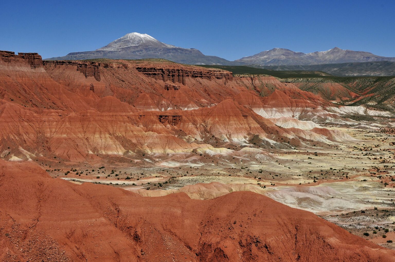
Una travesía corta, de 2 días y 1 noche, al extremo noroeste de la Argentina. No hay que confundirlo con el Valle de la Luna de San Juan: este está en la Puna de Jujuy, junto a Cusi Cusi, y sus cerros de colores se recorren a pie.

Hacia Cusi Cusi

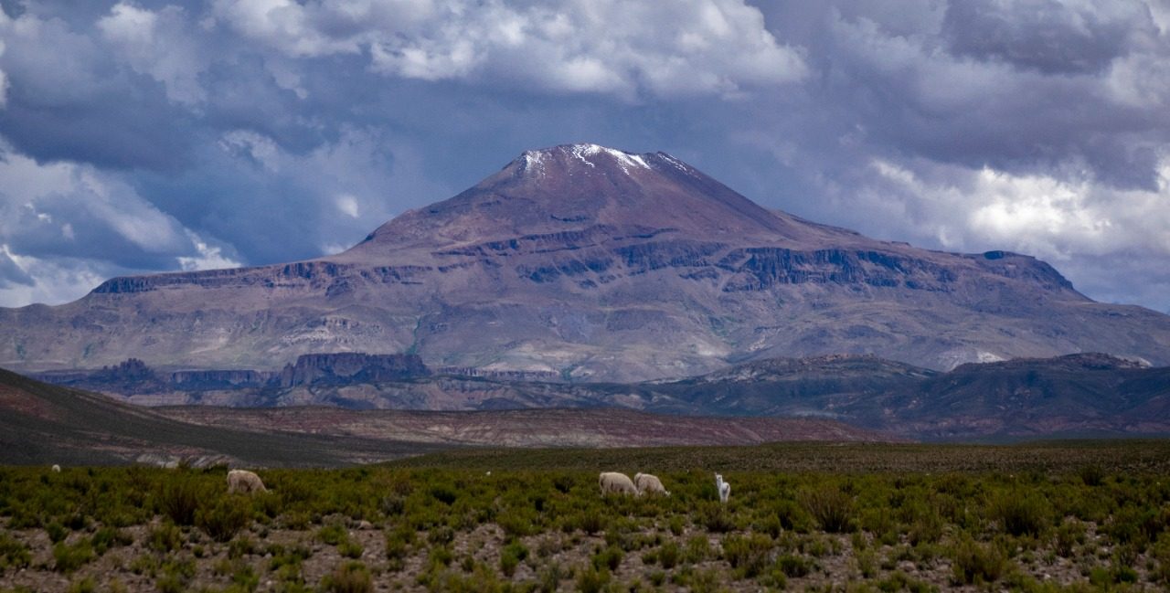
Salimos de Humahuaca hacia el norte por la Ruta Nacional 9, pasamos por Tres Cruces y el Cerro Huancar, y desde La Quiaca seguimos hacia la cordillera hasta Cusi Cusi, donde dormimos en un hospedaje familiar.

El Valle de la Luna

Caminamos el Valle de la Luna, junto al curso del Río Granadas, con tiempo para contemplar sus formas y colores, y conocemos la comunidad de Cusi Cusi. Volvemos a la Quebrada por el Abra de Laguna y Abra Pampa.

Day by day

Day1

Hacia Cusi Cusi

De Humahuaca a la Puna por Tres Cruces, el Cerro Huancar y La Quiaca, y de ahí hacia la cordillera hasta Cusi Cusi. Noche en un hospedaje familiar.

  1. 1Humahuaca2.950 m · km 0
  2. 2Tres Cruces3.700 m · km 57
  3. 3Cerro Huancar3.830 m · km 91
  4. 4La Quiaca3.450 m · km 171
  5. 5Cusi Cusi3.720 m · km 309
Day2

Valle de la Luna

Caminata por el Valle de la Luna, junto al Río Granadas, y regreso a la Quebrada por el Abra de Laguna y Abra Pampa.

  1. 6Valle de La Luna3.760 m · km 312
  2. 7Abra de Laguna3.950 m · km 335
  3. 8Abra Pampa3.490 m · km 439
  4. 9Humahuaca2.950 m · km 524

Altitude profile

+4.300 mhighest point 21 kmin a row above 4.000 m 2.940 mlowest point

Swipe the chart sideways to see the whole route →

Altitude profile of the route It starts at about 2.950 m, goes above 4.300 m and ends at about 2.950 m, over 524 km. 1.0002.0003.0004.000 123456789 0 km100 km200 km300 km400 km500 km

Altitudes from the Copernicus GLO-30 elevation model; they may differ depending on the measuring device. The numbers are the stops on the map.

The route

Relief map of the route with its 9 numbered stops
  1. 1Humahuaca
  2. 2Tres Cruces
  3. 3Cerro Huancar
  4. 4La Quiaca
  5. 5Cusi Cusi
  6. 6Valle de La Luna
  7. 7Abra de Laguna
  8. 8Abra Pampa
  9. 9Humahuaca

Relief: Copernicus DEM GLO-30 (© DLR e.V. 2010-2014 and © Airbus Defence and Space GmbH 2014-2018, provided by ESA under the Copernicus programme). Road: © OpenStreetMap contributors (ODbL).

What's included

Included

  • Transporte
  • Chofer/Guía
  • Refrigerios de viaje
  • Seguros de pasajer@s
  • 2 Boxlunch / Almuerzo
  • Monitoreo satelital

Before you go

Cancellation

You can reschedule or cancel under our cancellation and refund policy.

Questions

How long is the expedition?

2 days and 1 night.

How high does it go?

The highest point on the road is above 4.300 metres. There are about 21 km in a row above 4.000 metres.

How do I book?

Message us on WhatsApp, we agree on the date and confirm the booking by chat.

Shall we put your group together?

Expeditions run on dates we set with each group. Message us and we'll tell you about the next departure, or send this page to the people who'd travel with you.

Ask about dates